by Jenni Monet for Yes! Magazine
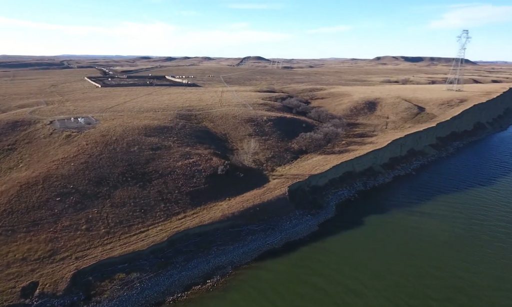
On the day a no-fly zone was lifted over Morton County and the Standing Rock Sioux reservation, Dean Dedman Jr. sent his drone into the sky and released some of the most dramatic aerial footage to come from the occupation. It was ?a shocking first look at the rapid advancement of the Dakota Access pipeline. For miles, the scraped and trenched earth extended all the way to a fortified drill pit, a strange and empty compound sitting practically on the edge of the Missouri River.
“What surprised me the most is how fast they got to that point, to the river,” Dedman said.
The next-day response from protesters, who call themselves water protectors, was to take action: They would try to occupy the undisturbed land resting between the compound and the river. The property belongs to the U.S. Army Corps of Engineers, an easement that the federal agency had designated for pipeline construction. As protesters approached the banks of Cantapeta Creek, they met police resistance. Militarized troops shot rubber bullets and dispensed pepper spray to drive the unarmed demonstrators away.
In the continuing battle over the Dakota Access pipeline, there is a sense that time is running out. And in this urgent fight, all sides—?the state, the tribe, police, and protesters—have vowed to stand their ground.
And that’s fitting. This conflict has much to do with that ground they’re all standing on, and digging in. It’s also about the history that determines who controls the land.